Cascade Heights in southwest Atlanta is in ZIP 30311, split between two high school zones. Zillow's typical value in 30311 was $230,014 in August 2026.
Last checked Oct. 6, 2026. Sources: the City of Atlanta’s official neighborhood boundaries, the Atlanta Public Schools zone map data, the state’s 2025 School Grades data, Zillow Research, the city’s parks inventory, MARTA’s schedule data and OpenStreetMap.
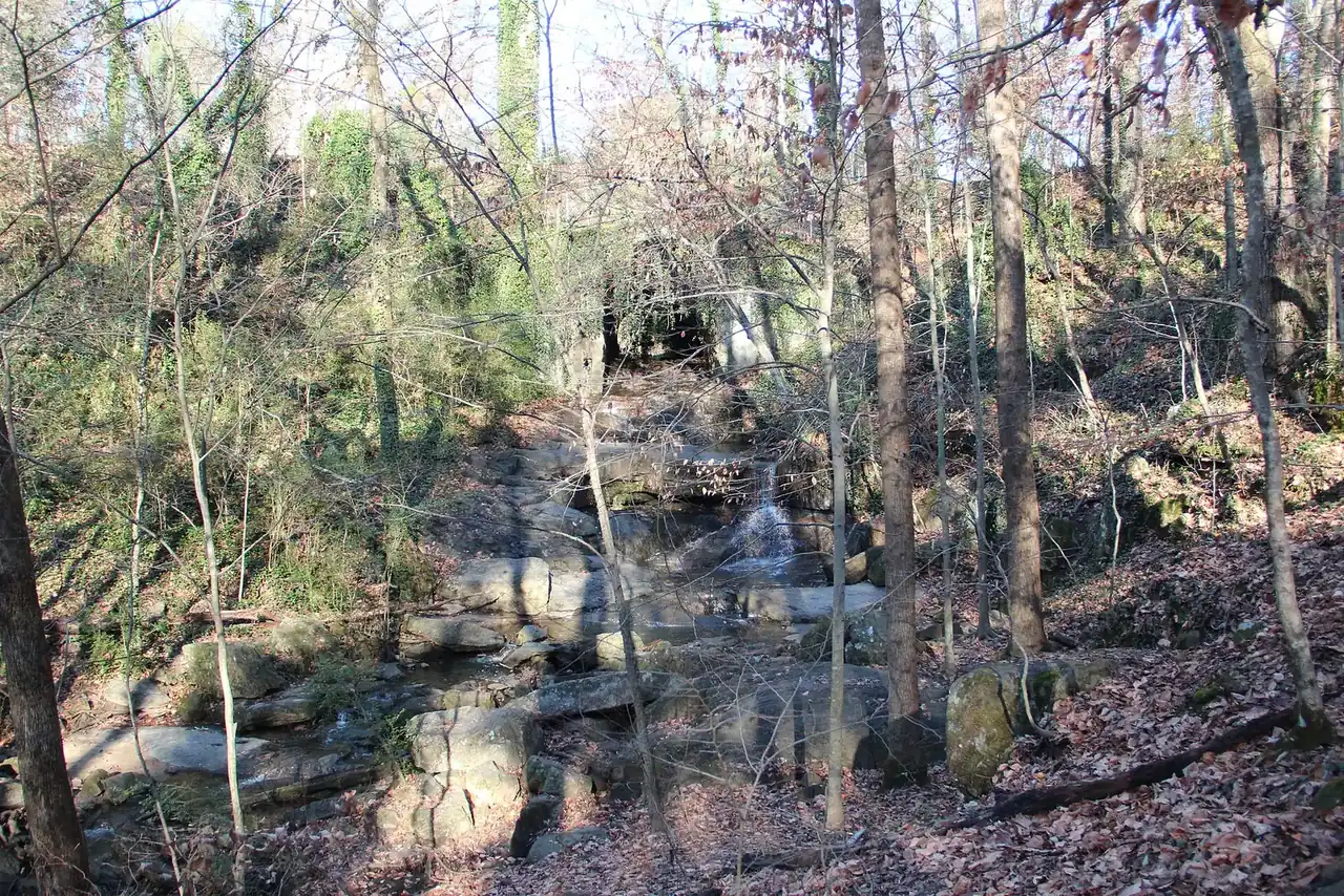
Cascade Heights is a neighborhood of mostly single-family houses along Cascade Road in southwest Atlanta, with the Cascade Springs Nature Preserve inside its boundary. The city’s official neighborhood map draws it as about 1 square mile in Neighborhood Planning Unit I, all in Fulton County.
What this means for you
- Zoned high school: split between D. M. Therrell High (58% of the land) and Benjamin E. Mays High (42%). Check one address on the district’s school zone maps.
- Home value: $230,014 in ZIP 30311 in August 2026, according to the Zillow Home Value Index.
- Nearest interstate exit: Interstate 285 exit 7, Cascade Road, to the west.
Part of our Atlanta neighborhoods guide.
Where it is
On the city’s map, Cascade Heights is an irregular area that follows Cascade Road. It is surrounded by other official neighborhoods: West Manor, Audobon Forest, Audobon Forest West, Laurens Valley, Green Forest Acres, Magnum Manor, Horseshoe Community, East Ardley Road, Southwest, Adams Park and Cascade Avenue/Road. The whole neighborhood is in ZIP code 30311.
Schools
Cascade Heights is in Atlanta Public Schools, and two high school clusters, Therrell and Mays, divide it. Shares are of the area’s land in the district’s zone map data on Oct. 6; scores are 2025 College and Career Ready Performance Index (CCRPI) figures from the state’s School Grades report.
| Level | School | Share of area | 2025 CCRPI |
|---|---|---|---|
| High | D. M. Therrell High, 3099 Panther Trail SW (report card) | 58% | 66.7 |
| High | Benjamin E. Mays High, 3450 Benjamin E. Mays Drive SW (report card) | 42% | 66.5 |
| Middle | Ralph Bunche Middle | 58% | 62.0 |
| Middle | Jean Childs Young Middle | 42% | 61.1 |
| Elementary | L. O. Kimberly Elementary | 58% | 76.5 |
| Elementary | Beecher Hills Elementary | 24% | 84.5 |
| Elementary | Cascade Elementary | 10% | 74.3 |
| Elementary | West Manor Elementary | 9% | 75.7 |
Because four elementary zones and two high school zones meet here, the address decides the school. The district lists every cluster on its feeder patterns page.
Home values
The typical home value in ZIP 30311 was $230,014 in August 2026, down 5.95% from $244,558 in August 2025, according to the Zillow Home Value Index. The index is a modeled typical value for the middle third of homes, not a sale price. ZIP 30311 is large and covers many southwest Atlanta neighborhoods around Cascade Heights. The citywide Atlanta figure was $381,948, down 2.02% on the year.
Parks and trails
From the city’s parks inventory:
- Cascade Springs Nature Preserve, 2852 Cascade Road SW: a 120-acre nature preserve with a drinking fountain.
- Veltre Circle, at the end of Veltre Place SW, a small green.
No BeltLine or PATH Foundation trail crosses the neighborhood on OpenStreetMap. More in our walking and biking trails guide and free things to do guide.
Getting around
- MARTA rail: no station within about half a mile, according to MARTA’s schedule data.
- MARTA bus: routes 66 (Brownlee Road and Harbin Road) and 71 (Cascade Road) stop inside the neighborhood; route 71 also runs to West End station.
- Interstates: Interstate 285 exit 7, Cascade Road, and exit 9, Martin Luther King Jr. Drive, numbered as in OpenStreetMap.
- Downtown and the airport: about 6.4 miles from the middle of the neighborhood to City Hall and 11.2 miles to Hartsfield-Jackson Atlanta International Airport. Both are distances on the OpenStreetMap road network measured with the OSRM routing engine, not drive times.
Groceries and everyday stores
From OpenStreetMap, inside the neighborhood or just outside:
- Nourish + Bloom Market, 2287 Cascade Road
- Kroger, 3425 Cascade Road SW
HOAs
The city’s neighborhood map does not list homeowners associations, so this page does not either.
Who serves Cascade Heights
It is inside city limits: the Atlanta Police Department, Atlanta Fire Rescue and the city’s Department of Public Works serve it, and property tax goes to the city, Fulton County and Atlanta Public Schools. Compare it with other areas in our neighborhoods guide.
Frequently asked questions
What high school is Cascade Heights zoned for?
It is split. About 58% of the neighborhood’s land is zoned for D. M. Therrell High and 42% for Benjamin E. Mays High, according to the Atlanta Public Schools zone map. Check one address on the district’s zone maps.
What ZIP code is Cascade Heights?
- Zillow put the typical home value in 30311 at $230,014 in August 2026, down 5.95% from August 2025.
How big is the Cascade Springs Nature Preserve?
120 acres, at 2852 Cascade Road SW, according to the city’s parks inventory, which lists it under Cascade Heights.
Is Cascade Heights a good place to live?
Here are the facts. Cascade Heights is a 1-square-mile neighborhood along Cascade Road in southwest Atlanta with the 120-acre Cascade Springs Nature Preserve. It is split between the Therrell High zone, 66.7 on the state’s 2025 CCRPI, and the Mays High zone, 66.5, and Zillow put the typical home value in 30311 at $230,014 in August 2026.
Have your say