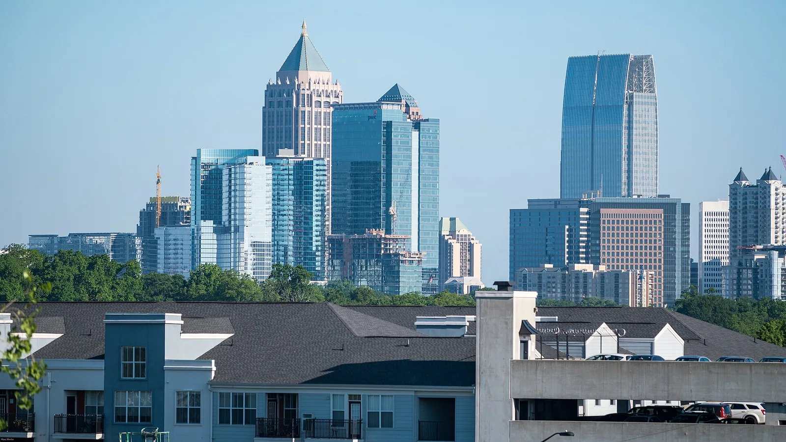
11 Atlanta neighborhoods from Buckhead Village to Cascade Heights: ZIP codes, zoned high schools and August 2026 Zillow home values, with a map.
Last checked Oct. 6, 2026. Sources: the City of Atlanta’s official neighborhood boundaries, the Atlanta Public Schools zone map data, the state’s 2025 School Grades data, Zillow Research, the Census Bureau and OpenStreetMap.
Atlanta is a city of 505,268 people, according to the Census Bureau’s 2020-2024 American Community Survey five-year estimates. Most of it is in Fulton County; its east side is in DeKalb County. The Downtown Connector, where Interstate 75 and Interstate 85 run together, cuts north and south through the middle, Interstate 20 crosses it east and west, Georgia 400 heads north from Buckhead, and Interstate 285 loops around the city’s edges. City Hall is at 55 Trinity Ave. SW, Downtown.
The city’s official map divides Atlanta into 248 named neighborhoods, grouped into 25 Neighborhood Planning Units, the citizen advisory districts lettered A to Z. This guide covers 11 of those neighborhoods, spread across the city.
Three things to know before you look at a listing:
- City limits and mailing addresses differ. Zillow’s ZIP code data labels 30340, 30345 and 30349 as Atlanta, but none of them is among the ZIP codes the Census Bureau counts as at least 10% inside the city. Check the city on the parcel with the Fulton County Board of Assessors or the DeKalb County Tax Commissioner before you count on Atlanta police, fire and trash service.
- Two counties, one school district. Kirkwood and East Atlanta are in DeKalb County and pay DeKalb’s county tax, but Atlanta Public Schools runs their schools, as it does across the city.
- School zones do not follow neighborhood lines. Downtown is split among four elementary zones and three high school zones, and Cascade Heights between two high schools. Always check one address on the district’s school zone maps.
The areas at a glance
High school shares are of each neighborhood’s land in the district’s zone map data on Oct. 6. Home values are the Zillow Home Value Index for August 2026: a modeled typical value for the middle third of homes in the whole ZIP code, not a sale price. The citywide figure was $381,948.
| Area | Main ZIP code | Zoned high school | Typical value, main ZIP |
|---|---|---|---|
| Downtown | 30303, 30313, 30308 | Midtown (76%), Washington, Jackson | $200,404 (30303) |
| Midtown | 30309 and 30308 | Midtown | $384,386 (30309) |
| Buckhead Village | 30305 | North Atlanta | $703,042 |
| Old Fourth Ward | 30312 and 30308 | Midtown | $445,097 (30312) |
| Inman Park | 30307 | Midtown | $730,526 |
| Virginia Highland | 30306 | Midtown | $954,793 |
| Grant Park | 30312 and 30315 | Maynard Jackson | $445,097 (30312) |
| West End | 30310 | Booker T. Washington | $267,305 |
| Kirkwood | 30317 | Maynard Jackson | $570,358 |
| East Atlanta | 30316 | Maynard Jackson (96%) | $397,330 |
| Cascade Heights | 30311 | Therrell (58%), Mays (42%) | $230,014 |
Map of the areas
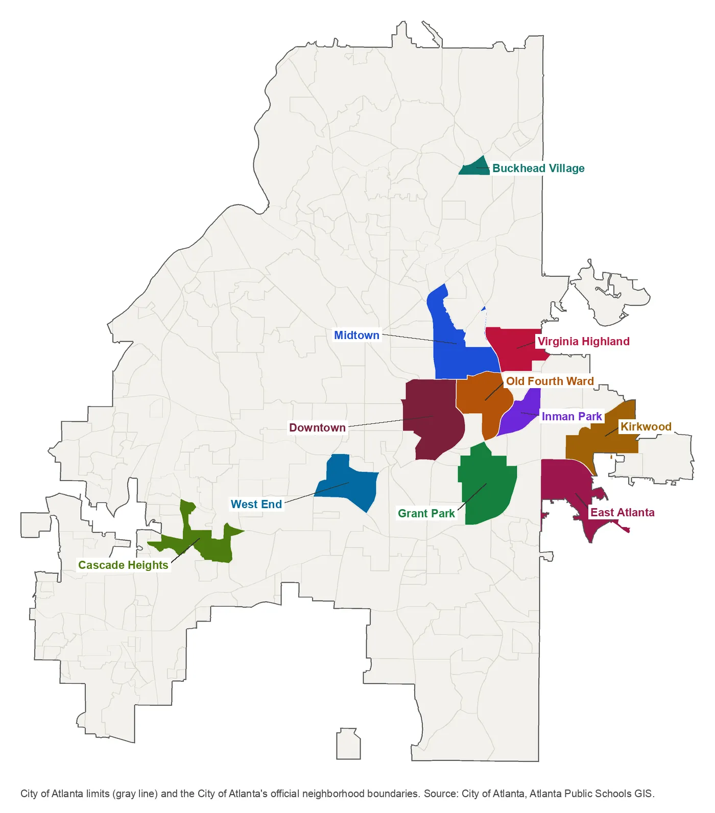
Map by Atlanta Live News from the City of Atlanta’s official neighborhood boundaries and the city limits layer in Atlanta Public Schools’ map service. The gray lines are the city’s other official neighborhoods.
North
Buckhead Village. The city’s official name for the small commercial district where Peachtree and Roswell roads meet, with apartments and condos among its stores. Zoned for North Atlanta High; the nearest Georgia 400 exit is exit 2.
In town
Midtown. Towers along Peachtree Street, older streets to the east and Piedmont Park on its east side. Three MARTA rail stations; zoned for Midtown High.
Downtown. The central business district, with City Hall, Woodruff Park and six MARTA rail stations inside its boundary. Split among four elementary and three high school zones.
Old Fourth Ward. Between Downtown and the Eastside BeltLine Trail, with Historic Fourth Ward Park and Ponce City Market. Zoned for Midtown High.
Inman Park. Older houses along Euclid and Edgewood avenues, the Eastside BeltLine Trail on its west side and a MARTA station on its edge.
Virginia Highland. Mostly single-family streets northeast of Midtown, with John Howell Park and Orme Park. Two elementary zones; no rail station nearby.
East and southeast
Grant Park. Built around the 131.5-acre city park that holds Zoo Atlanta, with Oakland Cemetery at its north end. Zoned for Maynard Jackson High.
Kirkwood. East-side neighborhood in DeKalb County with Coan Park, Bessie Branham Park and East Lake MARTA station on its edge.
East Atlanta. South of Interstate 20 in DeKalb County, with the East Atlanta Village business district and Brownwood Park.
Southwest
West End. Southwest of Downtown and just south of Interstate 20, with its own MARTA rail station and the Westside BeltLine Trail.
Cascade Heights. Single-family streets along Cascade Road and the 120-acre Cascade Springs Nature Preserve, split between two high school zones.
Comparing Atlanta with its neighbors
Tax rates, schools, home values and commutes for Atlanta, East Point, Hapeville and Decatur side by side: Atlanta vs East Point vs Hapeville vs Decatur. Trails and parks across the city: our walking and biking trails guide. The county and nearby towns: Atlanta, Fulton County and the neighbors.
How we built this
We named only neighborhoods a public source places on a map. The sources were:
- The city’s official neighborhood boundaries, the City of Atlanta’s planning GIS layer, which also gives each neighborhood’s Neighborhood Planning Unit and size. Every area in this guide is one of the 248 neighborhoods on that map, under the name the city uses.
- OpenStreetMap place names inside the city, which match the city’s names for Buckhead (placed in Buckhead Village), Midtown, Old Fourth Ward, Inman Park, Virginia Highland, West End, Kirkwood, East Atlanta Village and Cascade Heights.
- ZIP codes and school zones from the Census Bureau’s ZIP code areas and the Atlanta Public Schools zone map service, measured as shares of each neighborhood’s land.
We chose 11 neighborhoods spread across the city’s north, center, east and southwest; the other 237 on the city’s map are not covered here yet. The city’s map does not list homeowners associations, so these pages do not either. Store and place data are © OpenStreetMap contributors. The zone maps and the county’s parcel records are the authority for any one address.
Frequently asked questions
How many neighborhoods are in Atlanta?
The City of Atlanta’s official neighborhood map has 248 named neighborhoods, grouped into 25 Neighborhood Planning Units lettered A to Z. Our guide covers 11 of them.
Is all of Atlanta in Fulton County?
No. Most of the city is in Fulton County, but its east side, including Kirkwood and East Atlanta, is in DeKalb County. Those parcels pay DeKalb County taxes, and their children still attend Atlanta Public Schools.
Do Atlanta school zones follow neighborhood lines?
No. Atlanta Public Schools zone lines cut through several neighborhoods. Downtown is split among four elementary zones and three high school zones, and Cascade Heights between Therrell and Mays high schools.
Does an Atlanta mailing address mean the city of Atlanta?
Not always. Zillow’s ZIP code data labels 30340, 30345 and 30349 as Atlanta, but none of them is among the ZIP codes the Census Bureau counts as at least 10% inside the city. Check the parcel with the county before you count on city services.
Have your say