Old Fourth Ward is zoned for Hope-Hill Elementary, Howard Middle and Midtown High. Zillow's typical value in ZIP 30312 was $445,097 in August 2026.
Last checked Oct. 6, 2026. Sources: the City of Atlanta’s official neighborhood boundaries, the Atlanta Public Schools zone map data, the state’s 2025 School Grades data, Zillow Research, the city’s parks inventory, MARTA’s schedule data and OpenStreetMap.
The Old Fourth Ward sits between Downtown and the Eastside BeltLine Trail: rows of older houses, newer townhomes and large apartment buildings, with Ponce City Market at its northeast corner and Historic Fourth Ward Park in the middle. The city’s official neighborhood map draws it as about 1.2 square miles in Neighborhood Planning Unit M, all in Fulton County.
What this means for you
- Zoned high school: Midtown High, for the whole neighborhood. Check one address on the district’s school zone maps.
- Home value: $445,097 in ZIP 30312 in August 2026, according to the Zillow Home Value Index.
- Nearest interstate exits: Downtown Connector exits 248C (John Lewis Freedom Parkway) and 249B (Pine Street and Peachtree Street).
Part of our Atlanta neighborhoods guide.
Where it is
On the city’s map, the Old Fourth Ward borders Midtown and Virginia Highland to the north, Poncey-Highland and Inman Park to the east, Sweet Auburn, Cabbagetown and Grant Park to the south and Downtown to the west. Ponce de Leon Avenue runs along its north side, Boulevard and Parkway Drive run north and south through it, and John Lewis Freedom Parkway crosses it toward the Carter Center.
By land area it is 56% ZIP code 30312, in the south, and 44% 30308, in the north.
Schools
The Old Fourth Ward is in Atlanta Public Schools, in the Midtown cluster, and its zone lines do not split it. Scores are 2025 College and Career Ready Performance Index (CCRPI) figures from the state’s School Grades report.
| Level | School | Share of area | 2025 CCRPI |
|---|---|---|---|
| High | Midtown High, 929 Charles Allen Drive NE (report card) | 100% | 91.1 |
| Middle | David T. Howard Middle (report card) | 100% | 92.7 |
| Elementary | Hope-Hill (John Hope-Charles Walter Hill Elementary) | 100% | 64.0 |
The district lists every cluster on its feeder patterns page.
Home values
The typical home value in ZIP 30312 was $445,097 in August 2026, down 1.47% from $451,736 in August 2025, according to the Zillow Home Value Index. The index is a modeled typical value for the middle third of homes, not a sale price. ZIP 30312 also covers Grant Park and other neighborhoods south of here. In 30308 the figure was $323,139, down 2.95%. The citywide Atlanta figure was $381,948, down 2.02% on the year.
Parks and trails
From the city’s parks inventory:
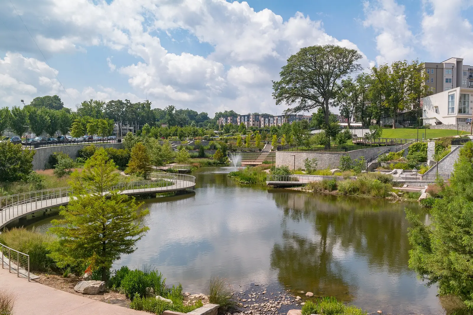
- Historic Fourth Ward Park, 664 Angier Ave. NE: 18.2 acres with a stormwater pond, two playgrounds, a splash pad, a skate park and restrooms.
- Central Park, 400 Merritts Ave. NE: 17.4 acres with a recreation center, four tennis courts, four basketball courts and sports fields.
- Renaissance Park, Piedmont Avenue at Pine Street NE: 5.4 acres with a dog park.
- J.D. Sims Recreation Center, 544 Angier Ave. NE, with two playgrounds and a basketball court.
- Freedom Park, 188.6 acres along John Lewis Freedom Parkway, which the city lists under the Old Fourth Ward and four other neighborhoods, with a dog park and a community garden.
The Eastside BeltLine Trail runs along the east side and the PATH Foundation’s Stone Mountain Trail crosses the neighborhood, according to OpenStreetMap. More in our walking and biking trails guide.
Getting around
- MARTA rail: no station inside the boundary. King Memorial, North Avenue and Civic Center stations are each about a third of a mile from its edge, according to MARTA’s schedule data.
- MARTA bus: routes 2 (Ponce de Leon), 7 (Boulevard) and 51 stop inside the neighborhood.
- Interstates: Downtown Connector exits 248C and 249B, numbered as in OpenStreetMap.
- Downtown and the airport: about 2.2 miles from the middle of the neighborhood to City Hall and 10.8 miles to Hartsfield-Jackson Atlanta International Airport. Both are distances on the OpenStreetMap road network measured with the OSRM routing engine, not drive times.
Groceries and everyday stores
From OpenStreetMap, inside the neighborhood or on its edge:
- Publix, 595 Piedmont Ave. NE
- Kroger, 725 Ponce de Leon Ave. NE
- Whole Foods Market, 650 Ponce de Leon Ave. NE
- CVS Pharmacy, 680 Ponce de Leon Ave. NE
- Walgreens, 215 North Ave. NE
HOAs
The city’s neighborhood map does not list homeowners associations, so this page does not either.
Who serves the Old Fourth Ward
It is inside city limits: the Atlanta Police Department, Atlanta Fire Rescue and the city’s Department of Public Works serve it, and property tax goes to the city, Fulton County and Atlanta Public Schools. Check the tax districts on one parcel with the Fulton County Board of Assessors. Compare the area with others in our neighborhoods guide.
Frequently asked questions
What schools is the Old Fourth Ward zoned for?
Hope-Hill Elementary, David T. Howard Middle and Midtown High, for the whole neighborhood, according to the Atlanta Public Schools zone map.
What ZIP code is the Old Fourth Ward?
30312 for the southern part and 30308 for the northern part. Zillow put the typical home value in 30312 at $445,097 in August 2026 and in 30308 at $323,139.
Is Ponce City Market in the Old Fourth Ward?
Yes. The market, on Ponce de Leon Avenue at the Eastside BeltLine Trail, is inside the city’s official Old Fourth Ward boundary.
Is the Old Fourth Ward a good place to live?
Here are the facts. The Old Fourth Ward is a 1.2-square-mile neighborhood east of Downtown with Historic Fourth Ward Park, Central Park and the Eastside BeltLine Trail. It is zoned for Midtown High, which scored 91.1 on the state’s 2025 CCRPI, and Zillow put the typical home value in 30312 at $445,097 in August 2026.
Have your say